In 1980, Richard Thorn and James H. Wilson described the natural divisions of Missouri in Transactions of the Missouri Academy of Science. Thorn and Wilson listed six divisions and a total of 18 distinct sections within the 6 divisions. For the sake of brevity and clarity we’ve reduced those natural divisions to 5 Missouri ecoregions:
- Big Rivers—The floodplains around two of the nation’s great rivers, the Missouri and the Mississippi.
- Osage Plains—The unglaciated 10 percent of the state in west-central Missouri, which includes what was primarily tallgrass prairie prior to human intervention.
- Mississippi Lowlands—The fiat farmland area in the southeastern corner of the state, including the Bootheel. It was once primarily swamps and bottomland forest, unlike any other part of Missouri.
- The Ozarks—Includes most of south Missouri and that corridor north of the Missouri River east of Arrow Rock. It is old and rugged, with much upland hardwoods and glades.
- The Glaciated Plains—Almost all of the state north of the Missouri River. It has a history of glaciation going back some 500 million years. The glaciated plains cover more than 30 percent of the state.
The Big Rivers
Humans have brought tremendous change to the great rivers since Lewis and Clark poled their boats the entire length of the Missouri River, often called the Big Muddy.
The rivers were wild places with wide floodplains, many oxbow bends, sloughs, marshes, and wet prairies. Riparian forest rimmed the Mississippi and sand bars and islands came and went with the floods, allowing such species as the least tern to nest. North of St. Joseph the Missouri flowed through the Great Plains, and these grasslands influenced the birdlife in northwest Missouri. Channelization and locks and darns have brought huge changes in the rivers and their place in today’s natural world; levees have contained the rivers and changed the floodplains into lush farmlands where miles-wide marshes were once home to wildlife. Islands and sandbars have disappeared as the rivers have been squeezed into a funnel by those levees beginning late in the 19th century.
In 1993, a thousand-year flood broke the levees on both the Missouri and Mississippi rivers and inundated millions of acres thought to be safe from the rivers. Missouri was hit the hardest. In some areas, as much as six feet of sand covered what had been prime farmland. The rivers had
reclaimed their territory. Since then, the old idea of restricting the rivers, primarily the Missouri, with higher and higher levees has been modified to allow wider flood plains and a national wildlife refuge in Missouri—the Big Muddy National Wildlife Refuge—was formed to manage those wider flood plains. Birdlife has prospered from the rivers’ destruction.
From a birder’s perspective, there are some positives that come with river control. One of the outstanding winter birding spots in the country is the Alton Dam area, just north of St. Louis. With open water all winter, it offers a roosting area for gulls and ducks; many of winter’s unusual sightings occur here. There’s a good chance you’ll run into Eurasian tree sparrows here, too.
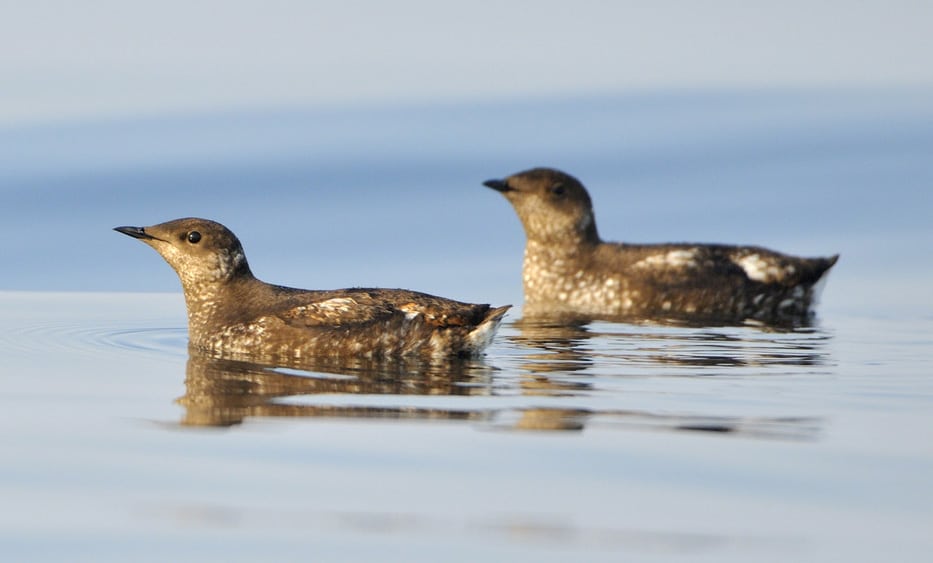
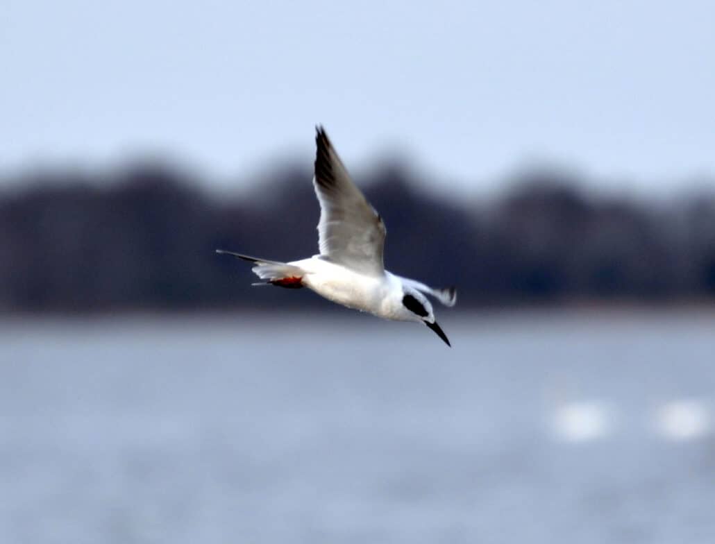
The lower Mississippi is the only known breeding site in Missouri for the least tern, and nesting areas for Mississippi kite, fish crow, and black-necked stilt are in the Mississippi floodplain adjacent to the Mississippi Lowlands. The upper Missouri offers the best chance to find western kingbirds and yellow-headed black birds, two species normally found farther west.
An interesting birding trip is a bike ride on the Katy Trail State Park. The 235-mile trail uses the old Missouri-Kansas-Texas roadbed (MKT, also known as the Katy) from St. Charles in the east to Clinton in the west. A hike along the Missouri River in central Missouri in both spring and fall will be time well spent, rewarding the bird watcher with a variety of migrant songbirds and spectacular scenery.
In winter, bald eagles follow the rivers, feeding on fish and waterfowl. They are found in abundance on the Mississippi between Alton Dam and Hannibal. The largest concentration is normally at Squaw Creek National Wildlife Refuge, located in the wide flood plain of the Missouri River, 40 minutes north of St. Joseph.
The length of the Missouri River in Missouri offers many stops of interest across the seasons. Starting in the northwestern corner, try these: Squaw Creek National Wildlife Refuge (a great stop any time); Little Bean Marsh (a 430-acre conservation area surrounding a 98-acre marsh where rails, bitterns, marsh wrens, and prothonotarv warblers will make your summer day); Franklin Island (near Boonville, just off the Katy Trail); Eagle Bluffs (Columbia’s wastewater treatment facility at McBaine); Reform Conservation Area (east of Jefferson City); Creve Coeur Marsh (in West St. Louis County); and Morais Temps Clair conservation Area (in St. Charles County).
Some significant birding stops on the Mississippi are Ted Shanks Conservation Area (south of Hannibal); Clarence Cannon National Wildlife Refuge (an hour north of St. Louis); Riverlands Environmental Demonstration Area and Alton Dam; and Big Oak Tree State Park (in New Madrid County).
The Osage Plains
The Osage Plains offer a number of outstanding birding spots and those stops are also some of the best places for botanizing. Some, such as Schell-Osage Conservation Area and a variety of prairies, are described later in this book. Osage Plains also offers the best opportunity in the state to witness the mating ritual of the greater prairie-chicken early each spring.
The Mississippi Lowlands
The Mississippi Lowlands were once the entrance to the Gulf of Mexico. As glaciers came and went and meirwater flowed southward toward the Gulf, the Mississippi and Ohio Rivers were formed and the Lowlands became the Mississippi River delta, which today is far south of Cape Girardeau.
For hundreds of centuries the landscape was primarily swamps and lowland forests. The Mississippi River shifted from its course near the Ozark Plateau some 18,000 years ago, but the Lowlands changed little until the late nineteenth century, when logging of the cypress and tupelo forests became big business.
Native Americans had populated the area because of abundant wildlife in pre-history. Still, when the area became a part of the United States as a part of the Louisiana Purchase, few people lived in the Lowlands. When Missouri became a state in 1821, there were no settlers in Stoddard and Dunklin counties. The swamp areas were considered to be inaccessible.
The logging industry forever changed the face of the Lowlands. Swamps were drained, the timber turned into railroad ties, and, when the timber ran out, the land was converted to agriculture. Mingo National Wildlife Refuge, Big Oak Tree State Park, Crowley’s Ridge, and Ten Mile Pond Conservation Area are the only tree-covered islands in this sea of agriculture—Missouri’s cotton country.
The Lowlands, which at three hundred feet above sea level is the lowest region in the state, also has the highest average temperature in the state and the highest rainfall. The Lowlands comprise 5 percent of the state’s area.
The area’s birds are more representative of southern species. Prior to the 20th century, anhinga was a common summer resident in the Bootheel area but all recent records of sightings are from the Lowlands. Today, fish crows and black vultures are common and black-necked stilt is a recent breeder in the Lowlands.
The Ozarks
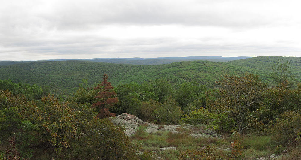
The Ozarks have been an exposed landmass for a quarter of a billion years. Glaciers, seas, floods, and wind have changed the landscape surrounding the Ozarks several times in 250 million years, but the Ozarks remain essentially the same.
Water has been an important factor, cutting through the underlying dolomite, limestone, granite, and chert, forming caves, springs, sink holes, and deep ravines. Though often called the Ozark Mountains, the Ozarks are not an uplifted area, but rather a plateau carved into a diverse habitat by the forces of time and nature.
The highest elevation in the state is Taum Sauk Mountain in Iron County at 1,772 feet. Nearby is Mina Sauk Falls, the state’s tallest waterfall at 132 feet. Missouri is alternately called the Cave State, the Spring State, and the Bat State. All are correct and all result from features of the karst topography located in the Ozarks.
Springs abound in the Ozarks. Many larger ones today are state parks, others are protected by the Department of Conservation or the Forest Service. They have their special ecosystems and are valuable nesting sites for resident summer passerines. Wrens, tanagers, vireos, warblers, thrushes, and sparrows can be found near springs.
Missouri has 5,700 caves and more are found each year. They are located in 78 of Missouri’s 114 counties, mostly in the Ozarks. The caves are home for Missouri’s fifteen bat species, including the endangered Indiana bat. Because hibernating bats conserve energy when undisturbed, many caves are closed to visitors during their hibernation period.
Missouri’s “Grand Canyon” is Grand Gulf State Park in Oregon County—a collapsed cave complete with a rock bridge, an underground stream, and an array of wildflowers and summer nesters, including summer tanager, Acadian fly catcher, and ovenbird. Another feature of the Ozark are glades—open, rocky areas of thin soil and scattered cedars. The glades in southern Missouri are home to greater roadrunner, prairie-warbler, painted bunting, and blue grosbeak, as well as flora and fauna that thrive in glade areas.
The Ozarks’ diversity makes it a birder’s paradise. Table Rock, Lake Taneycomo, the state’s National Scenic Rivers, the sprawling Lake of the Ozarks, most of the Mark Twain National Forest, Rock Bridge State Park, Devil’s Icebox Cave, and Stockton, Pomme De Terre, and Montrose Lakes are but a few of the Ozarks’ hundreds of birding hotspots.
The Glaciated Plains
The northern third of the state, most of the area north of the Missouri River, is the product of an ancient Ice Age, which occurred during the Pleistocene Epoch. Two major glacial sheets covered the state, the last receding some 400,000 years ago.
The ice left the state with the rolling hills that characterize the area today. The glaciers deposited the ingredients for rich soils—silts, sands, and gravel—and ground bedrock into fine sand, which was blown across the area as loess, a rich and productive soil. Today, the bluffs above the east bank of the Missouri River in northwest Missouri are loess that reaches a depth of 60 feet.
Tallgrass prairie dominated the Glaciated Plains before settlers showed up with their plows. At least half of the state’s 18,000 square miles of presettlement prairie was found on these plains. Today, only a few scattered plots remain. The land that once was prairie has supported agriculture for more than 150 years, and today can boast of some of the nation’s best yields of corn and soybeans.
The open country and more arid northwestern corner of the state sustains a Great Plains bird population including western kingbird, ring-necked pheasant, lark bunting, dickcissel, burrowing owl, and western meadowlark.
Although most of the year it is routine, birding the Glaciated Plains can be spectacular during migration. Swan Lake National Wildlife Refuge and Fountain Grove Conservation Area near Brookfield rival Squaw Creek as a rest stop for migrating waterfowl. Nearby Pershing State Park is an excellent summer habitat with a boardwalk (and Massasagua rattlers). Smithville Reservoir north of Kansas City, Mark Twain Lake in eastern Missouri near Mark Twain’s birthplace, and Thomas Hill Reservoir near Macon are excellent sites for bird watching during spring and fall migration.