Illinois contains at least 14 distinct bioregions, according to the Illinois Natural History Survey. These include the driftless region and Rock River Hill country in the northwest; the woods and ravines in the northeastern part of the state; the bottomlands of the upper Mississippi and Illinois rivers in the west-central part of the state; a grand prairie in north-central and central Illinois, the western forest prairie and the Shawnee Hills and coastal plain in the far south. These regions have distinct characteristics, such as soil composition, plant life, and in some cases, bird life, which define them. But even within these regions are subregions, smaller ecosystems, that can harbor a distinct group of plants and animals.
Other scientific entities divide Illinois into different ecoregions, for example, the U.S. Environmental Protection Agency names five basic regions. For birding purposes, I have divided Illinois into three main regions—the Driftless Region, the Central Plains and the Shawnee National Forest, with its associated highlands and cypress swamps.
What’s important to remember about ecoregions is that no true or clear lines divide them and that various transitional zones exist between them. Knowing this helps with watching and appreciating birds, because even a small piece of prairie in your backyard or a wooded lot might be a little ecosystem just right for some birds.
The Driftless Region
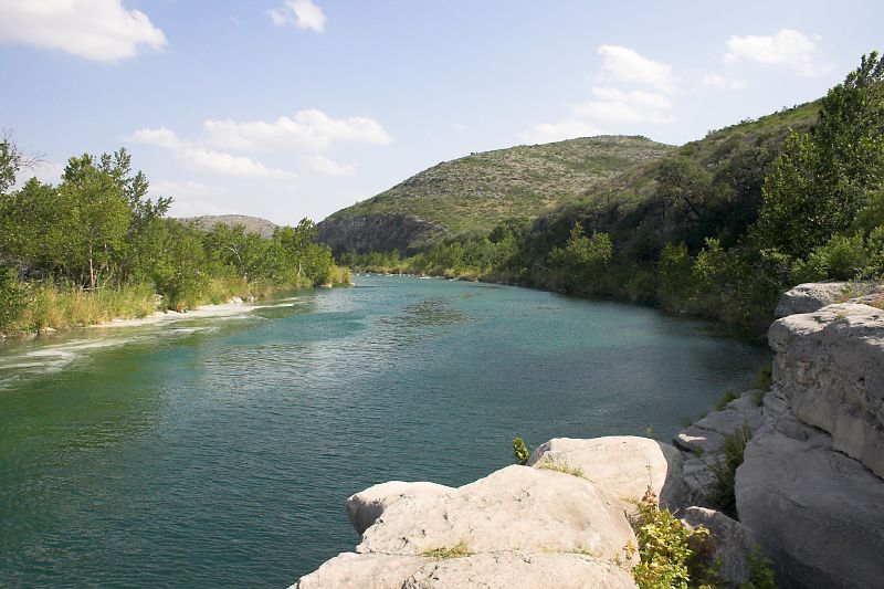
The Driftless Region, consisting of parts of southern Minnesota and Wisconsin, northwestern Illinois and northeastern Iowa, gets its name from having escaped the glaciers that covered neighboring areas. The glaciers leveled or smoothed out the surrounding landscapes. Meanwhile, erosion weathered the Driftless Region’s old bedrock until a series of deep valleys and rock formations were formed. Nearby glaciers deposited silt, sand, and gravel into the Mississippi River Valley.
Today, this rugged, scenic region is dominated by the Mississippi River, its accompanying backwaters, and large rock formations. The landscape consists mostly of oaks and maples, along with various ferns on north-facing slopes of wooded limestone bluffs and extensive stands of spring wildflowers such as Virginia bluebell and great white trillium. Sandy soils harbor prairie and savanna plants. Included within this region is the Mississippi Palisades State Park and the recently designated Lost Mound National Wildlife Refuge, much of which is a sandy substrate.
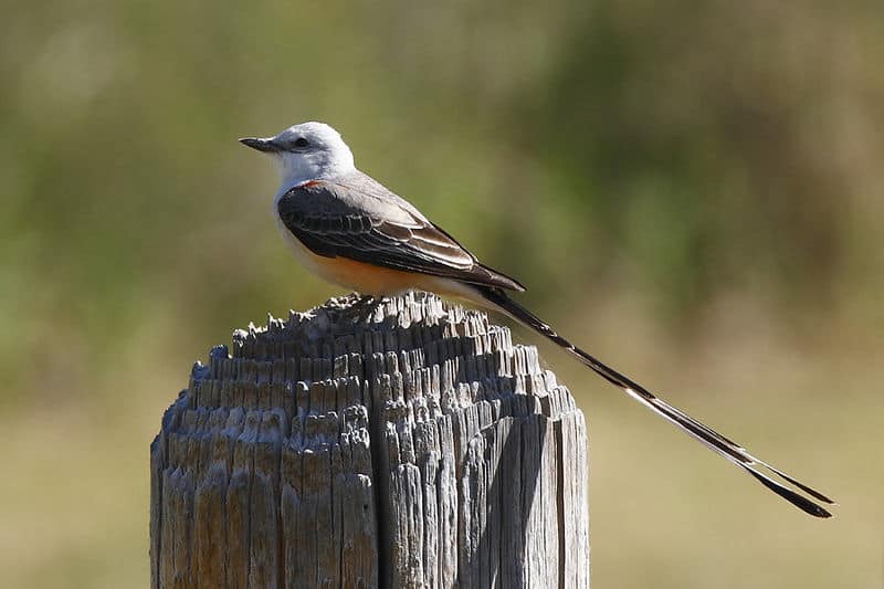
This unique habitat attracts some breeding bird species not normally found in northern Illinois, including the blue grosbeak, which uses sandy grassland habitat, along with yellow-throated warbler, Acadian flycatcher, Kentucky warbler and pileated woodpecker, which use large, old trees in river bottom areas.
The natural dune system at Lost Mound, some 4,000 acres, provides habitat for myriad grassland species including grasshopper sparrow, lark sparrow, dickcissel, and eastern and western meadowlarks. Smaller numbers of common nighthawk and upland sandpiper also breed in these grasslands.
The Mississippi River and its backwaters attract myriad waterfowl including many ducks and breeding herons as well as wintering bald eagle. Migrating ducks include northern pintail, gadwall, canvasback, common goldeneye, and lesser scaup. Countless songbirds also use the river valley, which lies in the Mississippi Flyway, for migration.
The Driftless Region represents a small portion of Illinois, and is the smallest region by far of the three listed here. But the bird diversity here is great and the protection being afforded it by the creation of Lost Mound National Refuge suggests it will continue to be a great natural area and to be even more accessible to birders in the future.
The Central Plains
The Central Plains, encompassing much of the northern two-thirds of Illinois except for the western river lowlands, represent a transitional zone between the continent’s eastern woods and the tallgrass prairies. Glaciers once inundated much of this region and helped created not only Lake Michigan but also bogs, wetlands, and prairie potholes. Glacier’s deposits turned into moraines, which are wooded hills. The glaciers also scoured the land and added till that created one of the richest soils in the world. These soils harbored thousands upon thousands of acres of tallgrass prairie and oak savanna, which teemed with bluestem, side oats grama and other native plants and wildflowers. Native Americans as well as natural lightning helped create fires in this region, sustaining the prairies and adding further nutrients to the soils. River valleys carved by glaciers, such as the Des Plaines, were natural fire breaks and allowed mature woodlands to grow.
Most of the native grasslands have been tilled for agriculture or destroyed for development. But Illinois still has some representative grasslands that contain most of the historical native bird species, and restoration and protection will continue to provide habitat for birds. One shining example of the native grasslands of yesterday is the Midewin National Tallgrass Prairie. This 19,000-acre mosaic of wetlands, grasslands and shrublands holds habitat for breeding birds that were once much more abundant in Illinois — the upland sandpiper, bobolink, loggerhead shrike (northernmost breeding location for this species in Illinois) and northern harrier. Plenty of smaller grasslands in this region attract meadowlarks, Savannah sparrows and other more common birds to breed. In winter, larger grasslands offer hunting habitat for the short-eared owl and northern harrier.
One of the nation’s most endangered ecosystems, the oak savannas grows in the central plains. A savanna contains roughly 20 to 30 percent tree coverage and is filled with grassland vegetation such as bottlebrush grass. The bur oak is the dominant tree species in a savanna; bur oaks are able to withstand prairie fires. Some bird species that frequent savannas include the rapidly declining red-headed woodpecker and the great crested flycatcher. Conservationists are working to restore savannas, many of which are degraded or have disappeared from the central plains landscape.
Probably 90 percent of the state’s wetlands have been drained to make way for development. These included central Illinois prairie potholes that provided tremendous breeding opportunities for mallards, blue-winged teal and other ducks, as well as marshes that attracted breeding ruddy ducks, yellow-headed blackbirds, pied-billed grebes, cranes, and various rails. The wetlands that mostly remain can be found in northeastern Illinois — those that are being protected as high-quality marshes provided habitat for some of these birds. Glacial lakes also dot the northeastern portion of this region. Though many are surrounded by development now, these deep lakes provide an excellent place for migrating ducks and loons to feed and rest.
The west central part of this region also contains various wetlands that have been manipulated to attract ducks and which are now being managed to help migrating shorebirds including the Lake Chautauqua and the Emiquon National Wildlife Refuges.
Today, numerous migratory birds use the river valleys and Lake Michigan shoreline created by geologic action to make their way to wintering and breeding grounds. Many warbler species as well as grosbeaks, thrushes, flycatchers and orioles flood through these areas in May and September. Others remain to nest in summer, including the wood thrush, eastern wood-pewee, rose-breasted grosbeak, red-eyed vireo, and scarlet tanager. The woods in the southern parts of the central plains region contain a more diverse list of breeding birds including summer tanager as well as scarlet tanager, yellow-throated vireo, red-eyed vireo, blue-gray gnatcatchers and tufted titmice.
The Shawnee National Forest
Glaciers never reached far southern Illinois, but other geologic action created the Shawnee Highlands and cypress swamps that dominate this region. Activity beneath the earth created the Shawnee National Forest and its highlands. Water running down these forest slopes created the canyons and steep hillsides. The varied topography includes bluffs as well as the lowlands and the flood plains of the Mississippi and Ohio Rivers. The flood plains are about 325 feet above sea level, while some nearby bluffs are more than 1,000 feet above sea level.
Heavy timbering threatened this region, but the Great Depression of 1929 halted the destruction and propelled tens of thousands of acres to be saved as the Shawnee National Forest. Today, the forest is again under threat for timber purposes; various groups are working to maintain the region’s high-quality woods and swampland habitat.
Today, you can find five different types of regions within the Shawnee National Forest that lies at the edge of the glaciated area. These ecosystems provide for a huge diversity of plants and animals. Here you’ll find oak/hickory uplands as well as buttonbush and bald cypress/black tupelo swamps meandering along the extensive Cache River. Many of the cypress are more than 200 years old. Tulip poplar and sweetgum as well as shortleaf pine also grow in this region.
Nearly 20 species of warblers including ovenbird, prothonotary warbler, and yellow-breasted chat breed in this region. Summer tanager, orchard oriole, barred owl, wood thrush, Carolina wren, Acadian flycatcher, and indigo bunting breed in the right habitat throughout the region. Whip-poor-wills and chuck-will’s-widow, which need large woods in which to breed, find the Shawnee National Forest a perfect place to do so. Black vultures and turkey vultures roost in the cypresses at night during summer. After the breeding season, the river backwaters and swamps abound with herons and egrets.
Visitors to southern Illinois may enjoy moments when they feel they have been transported back in time, as they hear green tree frogs calling from the swamps and pileated woodpeckers giving their jungle-like screams as they scan the wood of dying trees for their favorite food, carpenter ants.
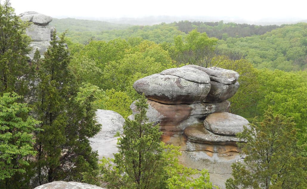
The Shawnee National Forest encompasses seven designated wilderness areas including Bald Knob, Bay Creek, Burden Falls, Clear Springs, Garden of the Gods, Lusk Creek and Panther Den Wildernesses. Here the adventurous hiker and birder can get some solitude among the amazing rock formations and scenic views.
Though much of Illinois’ modern landscape has been altered since it was created, you can still get a glimpse of what the state looked like 1, 000 years ago. In the Driftless Region you can wander up and down bluffs and look to the Mississippi River for ducks and herons that have used this corridor for eons. Or you can look to the sky and watch eagles and hawks that have flown through this region for millennia. In the prairies, you can walk among big blue stem and copious wildflowers during breeding season to listen for the songs of grassland birds whose voices have echoed across the central plains of Illinois for centuries. And you can traverse the river valleys interspersed among the prairies to observe the long tradition of songbird migration – birds have followed these river valleys for thousands of years during migration and they continue to do so today. In the southern cypress swamps, you step back into history when you watch birds as well. Walking among the cypress and black tupelo, so tall and so crowded, makes you feel as if you have stepped into another dimension. It’s dark and lovely in the swamps and the bird songs resonate as they always have, since long before humans entered the picture.