Kentucky lies within parts of three basic eco-regions: the Appalachian Plateaus, the Interior Low Plateau, and the Coastal Plain. These regions traditionally are split into smaller sections as follows: the Appalachian Plateau into the Cumberland Plateau and the Cumberland Mountains; the Interior Low Plateau into the Bluegrass, the Highland Rim, and the Shawnee Hills; and the Coastal Plain into the East Gulf Coastal Plain and the Mississippi Alluvial Plain.
Mississippi Alluvial Plain and East Gulf Coastal Plain (the Jackson Purchase)
The Mississippi Alluvial Plain encompasses only about 1 percent of the westernmost part of Kentucky. It lies almost entirely within a few miles of the Mississippi River and lowermost part of the Ohio River. Although this region was once almost completely forested and had many vast wetlands, today most of it has been converted to agricultural use. The East Gulf Coastal Plain includes all of Kentucky west of the Tennessee River (Kentucky Lake) that is not part of the Mississippi Alluvial Plain. The area comprises approximately 5 percent of Kentucky’s landmass. Originally, much of the East Gulf Coastal Plain was a mosaic of prairie and savanna-like woodlands but today most of the area has been converted to agricultural use and settlement.
The East Gulf Coastal Plain and the Mississippi Alluvial Plain together constitute the Coastal Plain eco-region in Kentucky, which is widely referred to as the Jackson Purchase in recognition of the land deal that added this area to the state in 1818. Despite the landscape changes that have occurred in the Jackson Purchase, many habitats remain intact and there are several state and federal natural lands that preserve examples of what the forests and swamps used to be like. Some of the most enjoyable places to visit include the Long Point Unit of Reelfoot National Wildlife Refuge, with its stately bald cypress trees, and the Ballard Wildlife Management Area, with extensive tracts of bottomland forest and floodplain sloughs. Swan Lake, the largest natural lake in Kentucky, is also part of a wildlife management area. And Kentucky’s newest national wildlife refuge, Clarks River, is situated in the northeastern quadrant not far from Kentucky Lake. In such places you can still see some of the conspicuous species of the area including great egrets, Mississippi kites, and prothonotary warblers. Proximity to the Mississippi River results in the presence of a great abundance of waterfowl during migratory seasons and in winter. Great flocks of geese often grace the winter skies along the Mississippi River, and bald eagles nest in several places. The rolling farmland that lies to the east of the river floodplains is full of birds of open ground and edge including loggerhead shrike, indigo bunting, blue grosbeak, and dickcissel.
Highland Rim
The Highland Rim is widely known as the Pennyroyal or Pennyrile. Less commonly it is called the Mississippian Plateau. The section comprises approximately 20 percent of Kentucky’s land mass. Before settlement, flatter portions of the Highland Rim were dominated by prairies and open-canopy forests known as barrens. The region’s relatively flat terrain and porous limestone geology enhanced the effects of fire, which was mainly responsible for maintaining these habitats. Forested areas in uplands were dominated by oaks and hickories. Today the landscape of the Highland Rim has been highly altered. Native prairies and barrens have been nearly eliminated. Bottomland forest has been cleared, and most of the wetlands have been drained and cleared. Forest cover remains relatively prominent only in hilly areas. Agricultural use of the land for row crops, hayfields, and pasture is considerable. The damming of the region’s major rivers has resulted in the creation of several large reservoirs including Green River Lake, Barren River Lake, and Lake Cumberland.
For the most part, the Highland Rim is a region divided into agricultural areas that offer some rural farmland and locally interesting waterbird opportunities, or rolling woodlands such as are found in the eastern and western transitional zones. Rural farmland of the region plays host to a variety of open ground species including eastern kingbirds, horned larks, and eastern bluebirds. At times of excessive rainfall, open fields of the south-central portion of the region can become magnets for waterfowl and shorebirds, and some of the most interesting birding opportunities are found in southern Warren County at the “transient lakes.”
At the western end of the region is the Land Between the Lakes National Recreation Area, one of the most exciting places to bird watch in Kentucky any time of year. The varied habitats of this National Recreation Area make it well worth a visit, but spring offers great opportunities for observing migrant songbirds such as warblers, vireos, tanagers, and orioles. Winter offers great viewing of waterfowl, gulls, and bald eagles. Adjacent Kentucky Lake hosts many waterbirds, but mostly from late fall through early spring. Lake Barkley just to the east hosts the state’s primary population of nesting ospreys, which are present from late March to early October.
Shawnee Hills
The Shawnee Hills section is widely known as the Western Coalfield. The region comprises approximately 20 percent of Kentucky’s land mass. Two escarpments ring the southern boundary of the region, creating greater relief and a higher degree of forest cover. The lowlands to the north, especially along the Ohio and lower Green rivers, are flatter. Although the Shawnee Hills was once dominated by extensive cover of forest, today much of the region has been converted to agricultural use and settlement. Surface mining has also altered much of this section significantly. As a result of mining activities, expansive areas of upland forest and farmland have been replaced by grassland and secondary forest of varying ages.
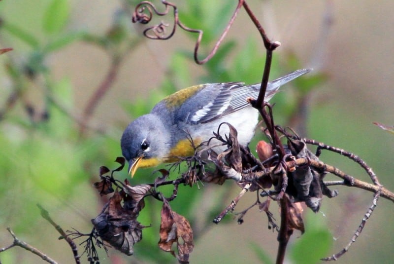
Despite the heavy use of this region by humans, the area remains predominantly rural and there are several wonderful natural lands including the Sloughs and Peabody wildlife management areas, Mammoth Cave National Park, and Pennyrile State Forest. Sloughs Wildlife Management Area covers a vast area of bottomland including open fields, beautiful cypress swamps, and bottomland forests and hosts many forest birds including northern parula, yellow-throated warbler, and prothonotary warbler; in winter waterfowl are abundant. Some of the waterfowl management units are excellent for marsh birds in spring and fall, especially on the Sauerheber Unit. Peabody Wildlife Management Area is situated mostly on reclaimed surface mines, and is being managed for grassland and edge species. In winter, large numbers of raptors use the area for hunting small mammals and birds. In spring and summer the area hosts some of the most significant populations of grassland species in Kentucky including nesting northern harriers, grasshopper sparrows, Henslow’s sparrows, and dickcissels, as well as edge species such as northern bobwhite, wild turkey, field sparrow, indigo bunting, blue grosbeak, prairie warbler, and yellow-breasted chat.
In contrast, Pennyrile State Forest and Mammoth Cave National Park are primarily forested lands where woodland songbird populations thrive. These are great places to find nesting woodland species such as wood thrush, Acadian flycatcher, eastern wood-pewee, pileated woodpecker, summer tanager, and red-eyed vireo. In winter, the woodlands host many songbirds including seven species of woodpeckers, brown creeper, golden-crowned kinglet, and hermit thrush. During spring and fall migration, these parks are wonderful places to find roving flocks of songbird migrants that include many warblers, vireos, flycatchers, and tanagers. At night from mid-April to mid-July, whip-poor-wills can be heard regularly, along with a few chuck-will’s-widows.
Bluegrass
The Bluegrass is the largest eco-region subsection in Kentucky, comprising nearly 30 percent of the state’s landmass. The region is commonly divided further into the Inner Bluegrass, the Outer Bluegrass, and the Knobs subsections. The vegetation of the Inner Bluegrass before settlement was unique in Kentucky. Open-canopy forest with a grassy ground cover dominated the region, but unlike the open prairies and barrens of the western part of the state, these savanna-like habitats apparently were maintained by a combination of fire, occasional drought, and great herds of bison that roamed seasonally through the region. Greater relief in the more rolling Outer Bluegrass and hilly Knobs sections resulted in near complete forest cover. Small openings known as cedar glades were present on some drier slopes, and in some areas these prairie-like habitats likely provided additional habitat for edge and grassland birds.
Today, most of the Bluegrass has been highly altered by human activity. Although use of the land for row-crop agriculture is common, most land has been converted to hayfields and pastures. This is especially true of the Inner Bluegrass, where well-manicured horse farms are the predominant feature. Settlement is still predominantly rural, although the state’s two largest cities, Louisville and Lexington, are located in the section, along with many smaller cities and towns.
Despite the high degree of settlement in this region, there are opportunities to see some of the characteristic birds. There are many state natural lands in the region including city and county parks around Lexington and Louisville. A few like Beargrass State Nature Preserve (Louisville) and the Lexington Cemetery are well-known songbird “migrant traps” in the region. Migrant traps are areas that seem to collect unusually large numbers of migratory birds. In these cases, the greenspace serves as an oasis to birds in a sea of houses and roads. The Kentucky River bisects the Bluegrass region and over many thousands of years it has cut a deep gorge through the limestone. Within this “Kentucky River Palisades” region are a number of state natural lands that can be great for bird watching. They host large numbers of songbirds migrants in spring and fall and support decent populations of breeding woodland songbirds in summer.
One of the most interesting spots for bird watching in Kentucky is the Falls of the Ohio at Louisville. This is the only section of the 980 mile Ohio River, where a series of rapids required a portage of goods being carried by river boat during the early settlement period and is the reason why Louisville sprung up where it did. Today the river has been highly altered with navigation dams, but a portion of the Falls of the Ohio has been preserved as National Wildlife Conservation Area. Viewing the Falls area is easy from the Falls of the Ohio State Park in adjacent Clarksville, Indiana, but through most of the year it is worth a visit. Great-blue and black-crowned night-herons occur seasonally, as well as double-crested cormorants, ring-billed and herring gulls, Canada geese, and many other migratory waterfowl and shorebirds. A spotting scope is highly desirable much of the year, but a leisurely walk with binoculars will often yield looks at most of the common birdlife.
Cumberland Plateau
The Cumberland Plateau is sometimes called the Eastern Coalfield. It is Kentucky’s second largest eco-regional section, comprising nearly 25 percent of the state’s land mass. A narrow band of land along the western boundary of the region is known as the Cliff Section where the topography is especially rugged, with extensive systems of clifflines and some caves. Before settlement the Cumberland Plateau was almost completely forested. In some areas, it is believed that a mixed pine-hardwood forest was maintained by fire and until a severe outbreak of southern pine beetles in 1999, such habitats hosted a small population of red-cockaded woodpeckers. Before the mid-1900s American chestnut was a common tree in the forests of eastern Kentucky. Mature bottomland forest dominated river floodplains, and early successional habitat was limited to the margins of natural openings.
Today the Cumberland Plateau remains primarily forested, although human impacts have been profound. Most of the floodplains have been cleared and settled. Surface mining for coal has resulted in the clearing of vast areas of forest in upland areas and on slopes. Most of the remaining forest has been logged.
And yet the area remains largely forested and the region affords great opportunities to view woodland species, especially because one of the state’s most significant public lands, Daniel Boone National Forest, lies within it. This National Forest, plus some additional areas such as Natural Bridge State Resort Park, Red River Gorge Geological Area, and Big South Fork National River and Recreation Area probably offer the richest variety of woodland habitats in the state. Characteristic species include acadian flycatcher, red-eyed and yellow-throated vireo, pileated and hairy woodpecker, northern parula, black-throated green, hooded, worm-eating, black-and-white, pine, and yellow-throated warblers, scarlet tanager, and many more. In some of the moister ravines with an abundance of rhododendron, the Swainson’s warbler can be found locally and in the Rock Bridge area of Red River Gorge, the red-breasted nuthatch nests in small numbers.
Cumberland Mountains
The Cumberland Mountains eco-regional section lies along the state’s southeastern border with Virginia. The section comprises only about 2 percent of Kentucky’s land mass, but it includes some of the most interesting topography in the state. It is essentially a narrow sliver of mountain ranges, defined to the northwest by the fairly continuous ridge of Pine Mountain. The summit of Black Mountain in Harlan County attains Kentucky’s highest elevation, at 4,150 feet. Before settlement the Cumberland Mountains were primarily covered in mature forest. Mixed pine-hardwood forests were found in drier areas. On lower slopes and ravines, richer forest predominated, with a good mixture of eastern hemlock and northern hardwoods in more protected areas. American chestnut was once very common throughout the region. Floodplains of the rivers and streams were covered by mature bottomland forest.
Today much of the Cumberland Mountains section remains forested, but human use has greatly altered portions of the region. Flat land in the river and stream floodplains largely has been cleared for settlement. Surface mining has been extensive in parts of the Black Mountain range. Logging of remaining forest has altered the forest structure. Settlement is largely restricted to rural strips along watercourses and the mouths of ravines. Likewise, agriculture is limited to the flatter land along rivers and streams. A northern hardwood forest type unique to Kentucky occupies the highest slopes of Black Mountain and along with the slightly cooler microclimate, attracts several species to nest that are found nowhere else in Kentucky.
A visit to this region of the state is bound to satisfy the desires of anyone wishing to view woodland birds. A variety of state and federal natural lands including Cumberland Gap National Historical Park, Pine Mountain and Kingdom Come state parks, Bad Branch and Blanton Forest state nature preserves, and Breaks Interstate Park all afford excellent trail systems and opportunities to view hooded warbler, scarlet tanager, indigo bunting, wood thrush, pileated and hairy woodpeckers, and many other woodland species. The Swainson’s warbler is locally distributed in this region, occurring along cool, rhododendron filled ravines. And for the ardent bird watcher, a trip up Black Mountain to hear and see the nesting veeries and chestnut-sided and black-throated blue warblers is a must.


