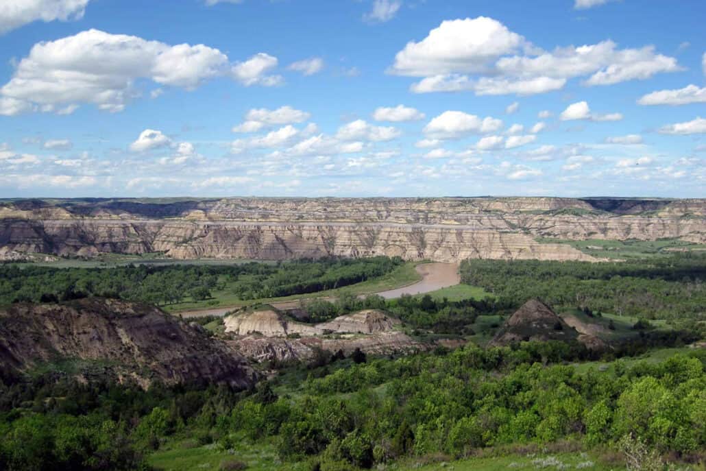
Not far from the Mexican border, you’ll find one of the most intriguing and diverse environments imaginable. Nestled in south-central New Mexico are long, arid stretches of the Chihuahuan desert beside forested mountaintops and mesas with mule deer and bighorn sheep. You’ll see verdant oases and have an opportunity to visit two national wildlife refuges, one of which draws visitors from around the world and is a crown jewel of the refuge system.
Once a heavily traveled 1,500-mile trade route, El Camino Real, the Royal Road linked Mexico City with what is now Santa Fe and was used by indigenous peoples of the Southwest, adventurers, Spanish explorers, Catholic missionaries, and settlers in the 1600s and beyond. You can follow the Royal Road over a 225-mile stretch from Las Cruces to Albuquerque, where you’ll find desert, alpine forest, grassland, and riparian species at nearly a dozen excellent birding spots.
This section of El Camino Real is along two scenic and historic byways and New Mexico’s Fiber Arts Trail, where you can enjoy native artisans’ weavings, colorful textiles, and jewelry. You’ll pass by pecan orchards and vineyards as you skirt the Organ, Salado, and Chupadero Mountains; the Loco Hills; and the Fra Cristobal Range. The environment includes waterless open range, where cattle freely roam, as well as trendy ski resorts that cover hillsides near the national forests on the outskirts of Albuquerque.
Las Cruces Area
Las Cruces is a good starting point for a trek along the Royal Road. The city is a bustling upscale metropolitan area, with many amenities and a colorful downtown artisan marketplace. Although the city is growing rapidly and pushing farther from the banks of the Rio Grande River, you’ll quickly pass beyond construction equipment to the surrounding desert.
To the east of Las Cruces, you’ll pass through San Augustine Pass at an elevation of 5,719—roughly half as high as the highest mountaintops heading north of the Rio Grande River. Once a prosperous mining area, the Organ Mountains are nowadays a favorite recreation spot of mountain bikers, wildlife watchers, and hikers.
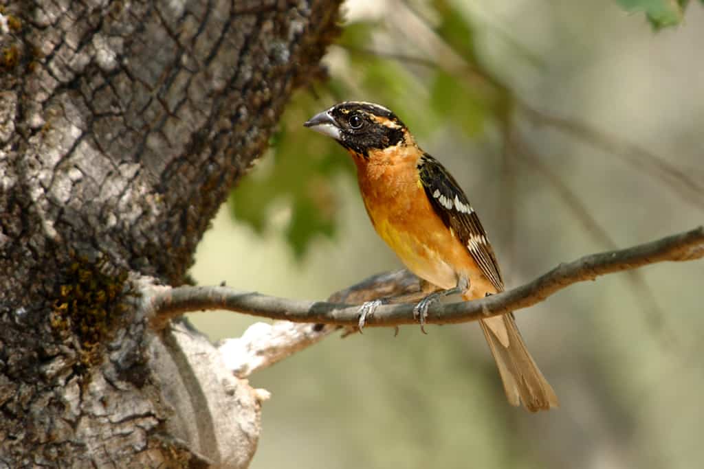
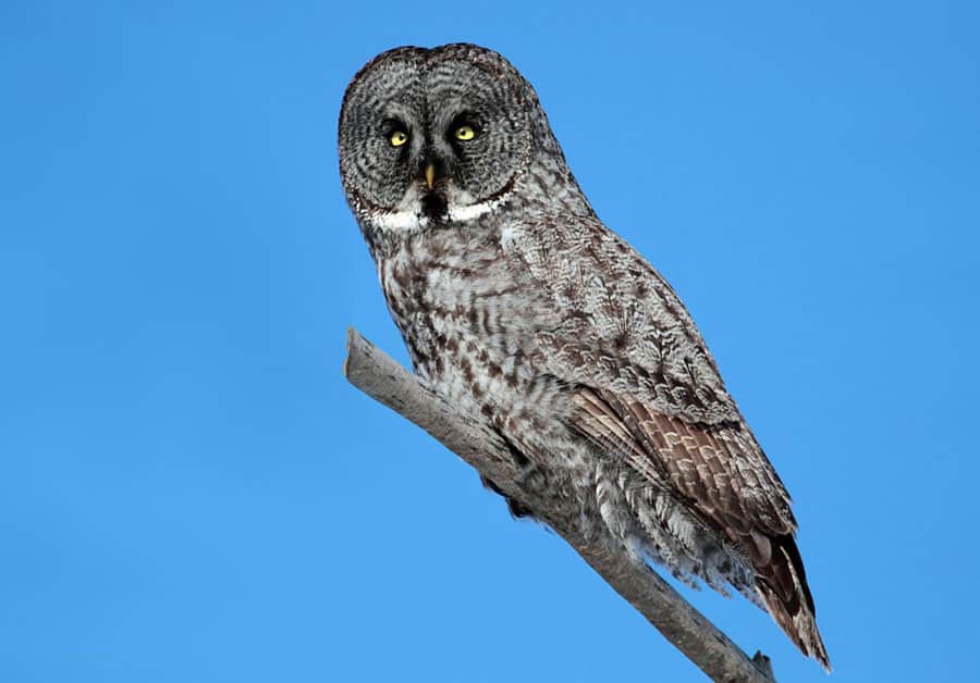
There are two birding spots east of Las Cruces that you’ll surely want to visit during early morning hours. A few miles east on State Route 70, watch for signage for Dripping Springs Recreation Area, a Bureau of Land Management (BLM) site near White Sands. Dripping Springs Trail and another trail through the main picnic area have good habitats of brush, desert, and forest stands, where you’ll most likely find orioles, black-headed grosbeaks, sage thrashers, ash-throated flycatchers, and both eastern and western bluebirds.
A few miles farther on State Route 70, you’ll find Aguirre Springs National Recreational Area, another BLM site. This site in the Organ Mountains has several perennial springs and two hiking trails, one of which, Pine Tree Trail, is a four-mile loop that climbs to the base of the Organ Needles (needle-like spires) in Ponderosa pine habitat.
Although Pine Tree Trail has stretches of steep terrain, it is an excellent pathway to find plumbeous, gray, and Hutton’s vireos and black-chinned sparrows in summer. You should have a good chance to spy Virginia’s and Grace’s warblers, as well as black-throated grays. You needn’t climb too many steep stretches to find most target birds.
Las Cruces to Socorro
From Las Cruces, you can either head north on Interstate 25 or follow State Route 185, a byway that parallels the interstate. Routes 185, 187 and 1 follow the interstate highway and are unhurried back roads with little traffic. You’ll be following a portion of El Camino Real, and, although signs of the Royal Road have long vanished and been replaced by the interstate, the byways will give you a sense of trail’s terrain as it was when travelers followed the Rio Grande on the north-south route.
A few miles north of Las Cruces, you’ll find Fort Selden State Monument, a remnant of a landmark fort built to protect settlers from Apache Indians and outlaws. The site once hosted Buffalo Soldiers, the name Native Americans used to describe black troops in the Old West. Stop by the visitor center for a historical perspective of the fort’s importance during the late 19th century, and if you visit during summer, you’ll often find living history demonstrations on weekends.
Before reaching Truth Or Consequences (“T or C” on local signs), you’ll find two state parks well worth visiting: Percha Dam and Caballo Lake. After driving through the desert, these parks are welcome oases.
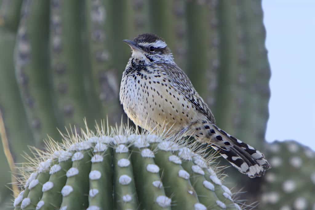
At Percha Dam State Park, you’ll enjoy stately cottonwood and Russian olive trees near a 11,500-acre lake that offers good fishing as well as birding. Local birders consider this site to be one of the best migrant traps in the state, and after a spring morning around the cottonwoods and streamside vegetation, you’ll be a believer. The desert is nearby, and you’ll have opportunities to find cactus wrens, phainopeplas, and other desert species. Keep an eye out for raptors; this is a good spot to spy Swainson’s, Harris’s and ferruginous hawks.
At nearby Caballo Lake State Park, you’ll have a chance to see both bald and golden eagles that arrive in November to nest along the reservoir banks and hillsides. There are several short trails to explore, but you may find this park busier than Percha Dam and with a sparser birding habitat. Yet, the southern campground along the banks of the Rio Grande can be lively, despite a large RV rally site nearby. The park is a great place to find various species of blooming cacti in the springtime.
As you drive north from Caballo, you’ll be on a short stretch of the Geronimo Trail National Scenic Byway that loops westward through territory of the legendary Indian warrior. In the town of Truth or Consequences, be sure to stop at the Geronimo Trail Visitors Center and Geronimo Springs Museum to see detailed exhibits on Geronimo and local history. Geronimo Springs Museum and sister-site Celestial Creations are stops on the New Mexico Fiber Arts Trails, as is nearby Grasshopper Silk in Elephant Butte.
North of T or C, Elephant Butte Lake is the largest and most popular lake in New Mexico. A dam built in the early 1900s across the Rio Grande River created a lake that is 40 miles long with over 200 miles of shoreline. This area has become a favorite vacation destination because of great fishing, boating, and hiking opportunities.
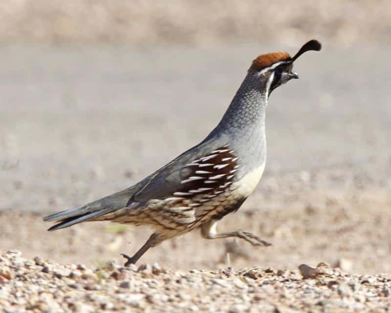
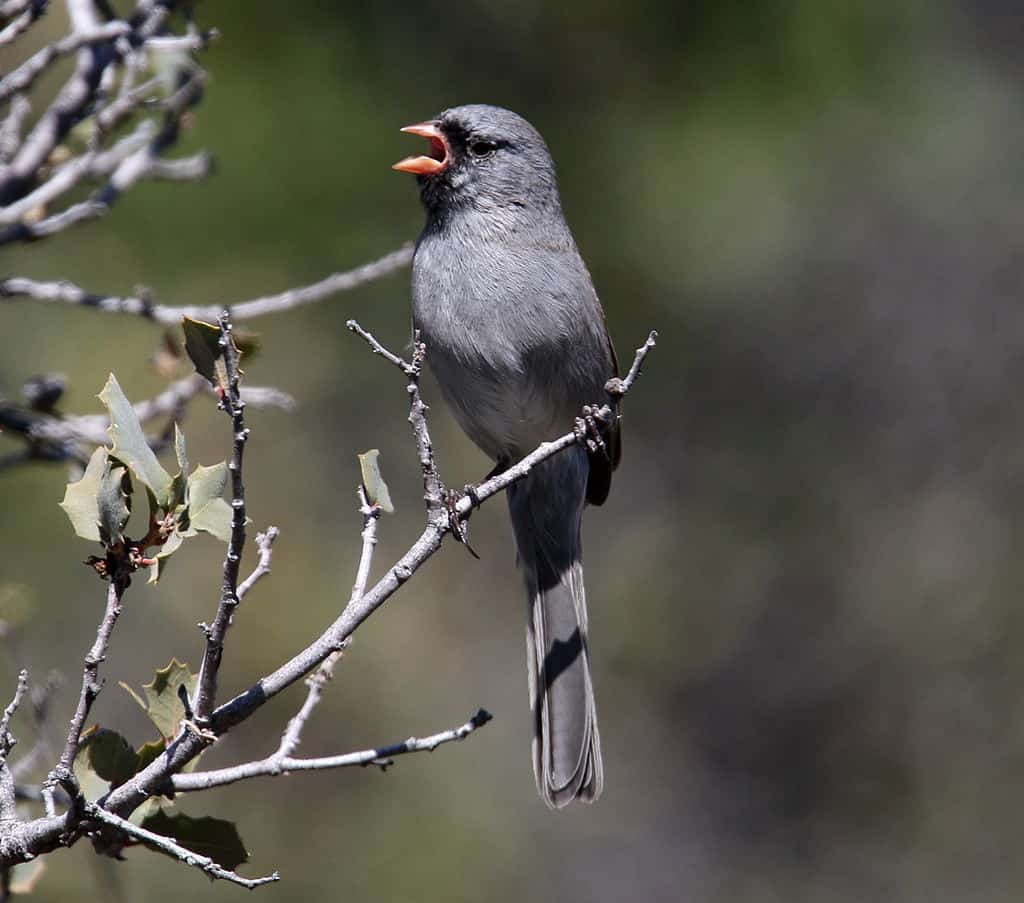
The Elephant Butte area is one of the driest stretches along the Rio Grande despite the huge lake. Away from the park amenities, you’ll have an opportunity to find sage and black-throated sparrows along the park’s desert edges, as well as Gambel’s quail and white-winged doves. On the lake, you’ll often see a large raft of grebes, including Clarke’s, western, and eared. During shorebird migrations, the mudflats may have a large number of birds and a scope is usually needed for identification.
Thirty miles south of Socorro is a cluster of three historic sites that commemorate Indian lore, Civil War battles, and the famous El Camino Real trade route. The visitor center at the El Camino Real International Heritage Center is an excellent spot to view several interpretative exhibits about the ancient route used by explorers, traders, missionaries, and settlers.
At the Fort Craig National Historic Site, you’ll see the site of one of the largest forts in the Old West, built to protect El Camino Real, first from Indian raiders and later from Confederate soldiers who approached along the Rio Grande to confront Union defenders. At the nearby Valverde Battlefield, the two forces engaged in a decisive pitched battle that eventually led to the Confederate retreat along the Rio Grande back to Texas.
Heading north again on route 1, Bosque del Apache National Wildlife Refuge is a premier birding site along the Royal Road. The name is Spanish for “woods of the Apache” and the refuge has miles of riverfront habitat as well as large pools with water levels regulated by pumps and dikes. The combination of Chihuahuan desert, patchy grassland, huge cottonwood trees, and riparian vegetation attracts more than 350 species of birds to the refuge.
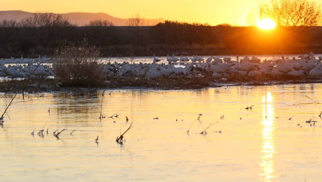
Visitors from around the globe come to Bosque del Apache refuge to view thousands of sandhill cranes, snow geese, and bald eagles that overwinter on the refuge, and an annual festival of the cranes is held the weekend before Thanksgiving.
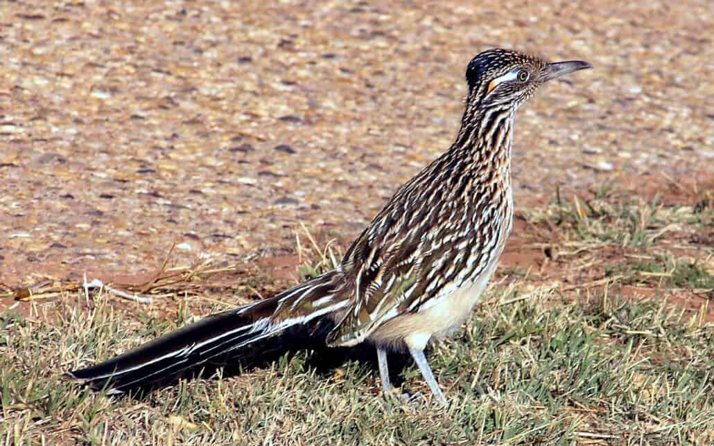
A main feature of the refuge is a 15-mile loop divided into a marsh loop of 7 miles and a farm loop of 7½ miles. Driving the loops, you’re apt to see disparate species, ranging from green-wing teal and roadrunners to American kestrels and black phoebes. You’ll find several observation decks from which to scan crane flocks as they feed in the grasses, and occasionally you may spot an endangered whooping crane or two among the sandhills.
The farm loop is actively managed to provide grain crops for geese, cranes, and other waterfowl. Corn is a staple food source, but cranes won’t enter a 6-foot tall cornfield because of possible encounters with predators such as coyotes. So, in February the corn stocks are “bumped,” or knocked over by refuge staffers who circle the fields on tractors. Three weeks later, the crops are mowed to the ground so ducks and geese can forage among the harvest.
In addition to the autoroute, you’ll find several trails to explore, varying in length from 1½ to nearly 10 miles. Taking any of the trails will reveal different sides of the refuge and bring you new species. The River and Rio Viejo trails along the Rio Grande and portions of the Chupadera Trail will get you into prime riparian and arid environments to find many of the refuge’s breeding birds: curve-billed and crissal thrashers, verdin, and bushtits, Chihuahuan ravens and western scrub-jays, as well as black-chinned hummingbirds, vermilion flycatchers, and the endangered southwest willow flycatcher.
Because of the unusual and varied habitats that draw such rich bird life to the refuge, photographers flock to it in all seasons. You’ll have spectacular sunrises and sunsets, with huge flocks of geese and cranes gliding and crisscrossing overhead.
Just north of the refuge is the town of Socorro, a source for motels, restaurants, and supermarkets. Even if you don’t tarry long in Socorro, have a look at the Garcia Opera House along the main thoroughfare. This historical building was built in 1884-87 and restored in 1985. Its 34-inch-thick walls are curved to strengthen the building and improve acoustics. Its “rake stage,” typically sloped upwards away from the audience, is one of few in the country that have been preserved. The architecture of the building is decidedly unusual.
Socorro to Albuquerque
Roughly 20 miles north of Socorro, you’ll find Sevilleta National Wildlife Refuge, 228,000 acres of semiarid uplands amid the Chihuahuan desert and Rio Grande basin. The refuge bird checklist includes 217 species, but there is little access to the vast refuge.
You can enter the refuge at exit 169 off Interstate 25, where you’ll find two units open to visitors located along the Rio Grande and Burlington Northern Santa Fe railroad track. Be sure to pick up an indispensable map at the refuge headquarters for directions to find your way to Units A and B. The endangered southwest willow flycatcher is the refuge target bird, a species that breeds here but migrates to Mexico and Central America. Their preferred territory is among the willow and cottonwood trees near the river.
Driving the refuge road, if and when you encounter a closed gate, simply park and walk southward along the river course. When you reach the seasonal Rio Salado, you’ve reached the southern boundary of Unit B. Continue along Rio Salado east toward the Rio Grande to find swallows, wrens, sparrows, woodpeckers, and other desert species.
North of the refuge, when you reach Albuquerque, consider two more sites not far from the Royal Road: Sandia Crest among upscale ski resorts, for rosy-finches from November through March at an elevation of 10,600 feet, and a hawk watch site in the Manzano Mountains near the town of Manzano.

For good looks at gray-crowned, brown-capped, and black rosy-finches, head east of Albuquerque on Interstate 40 and north on State Route 14. Follow the signs to Sandia Crest and look for the birds around the parking lot before reaching the top. Sandia Crest House, your destination, has a gift shop and restaurant with grand panoramas as well as several feeders that attract rosy-finches.
You can reach Manzano hawk watch, southeast of Albuquerque, by leaving Interstate 40 at exit 175 and following State Route 337 south to the town of Manzano. In Manzano, follow the signs to New Canyon Campground (roughly 9 miles of forest road). Near the end of the road, you’ll see a fire tower from which a trail leads across an alpine meadow to the observation site. The Manzano hawk watch website has a helpful map to guide visitors to the HawkWatch International site, where thousands of raptors are counted and banded from the middle of August through October.

Looking to Subscribe?
Get 6 print issues of the magazine delivered to your door
& free digital access
- One Year Print Subscription: $26
(to US or Canada, includes digital access) - One Year Digital-only Subscription: $15
- Two Year Print Subscription: $48
(to US or Canada, includes digital access)